To provide a basic introduction to how potential vorticity dynamics can be used to understand the development, structure, and evolution of synoptic scale weather systems.
To improve understanding of the influence of topography on the structure of the time-mean upper-level flow and the development of extratropical cyclones.
Problem 1:
A westerly zonal flow at 45 N is forced to rise adiabatically over a north-south-oriented mountain barrier. Before striking the mountain the westerly wind increases toward the south at a rate of 10 m/s/1000 km. The upwind lowlands are at 1000 mb, the crest of the mountain range is located at 800 mb, and the tropopause is located at 300 mb. What is the initial relative vorticity of the air? What is its relative vorticity when it reaches the crest if (1) the earth's surface upwind of the mountains is located at 1000 mb and (2) the flow is deflected 5 degrees latitude toward the south during the forced ascent? If the current assumes a uniform speed of 20 m/s during its ascent to the crest (i.e. there is no horizontal speed shear), what is the radius of curvature of the streamlines at the crest.
Problem 2:
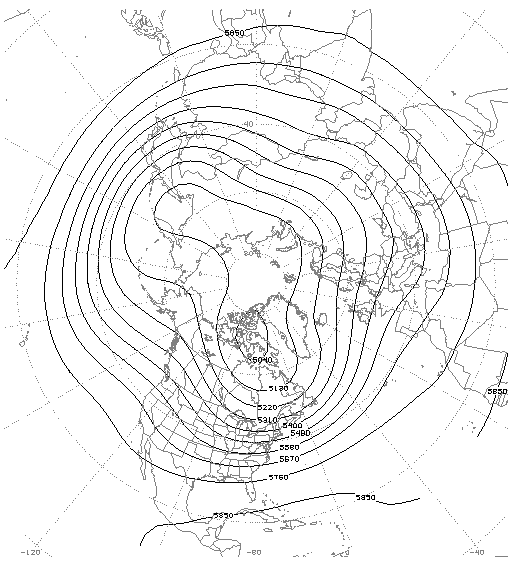
If the earth was purely uniform, with no topographic or land-surface contrasts, the climatological upper-level flow would likely be nearly zonal. However, the observed wintertime 500 mb flow is characterized by several major troughs and ridges. Several factors contribute to the existence of these features, including the topography of the northern hemisphere. Using the climatological 500 mb geopotential height analysis identify major troughs and ridges using dashed and jagged lines, respectively. Where are these troughs and ridges located relative to major topographic features (i.e., the Himalaya, Rockies, and Alps)? Are these positions consistent with your understanding of potential vorticity? Explain. In addition to mountains, what other factors may be controlling their locations?
Problem 3:
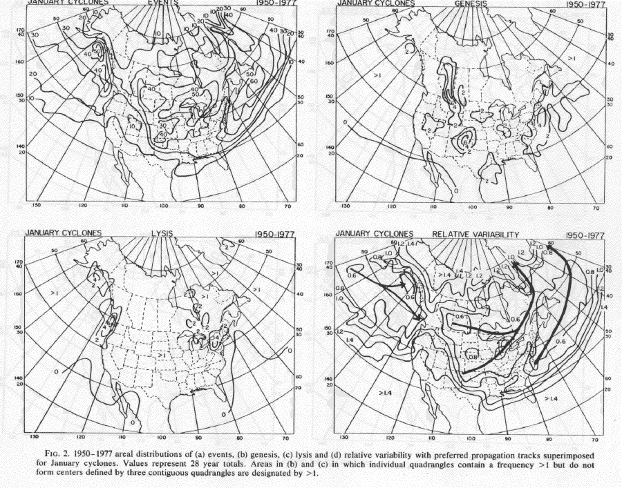
Based on the climatology developed by Zishka and Smith (1980), where relative to major mountain barriers are these regions of frequent cyclogenesis and cyclolysis. How might potential vorticity be used to partially explain some of the areas of frequent cyclogenesis and cyclolysis?
