A Satellite-based Tropical Cyclone Module for METEO 6310 (Tropical Meteorology)
Haiyan Jiang
The module begins with a general overview of global tropical cyclones (TCs) including their definitions and structure, and introduction of satellite instruments and brief remote sensing theories on precipitation and cloud. Research and forecast status and challenges on TC precipitation and intensity change will be introduced. Special attention will be given to interpretation of synoptic evolution of TCs using satellite images. Five lectures and two problem sets are given as below:
Lectures:
Lecture 1: TC best track definition and datasets, global distribution of TCs; Review of history of meteorological satellites, introducing different orbits, scanning patterns, and space-time samplings. Also introduce the differences between the satellites and the instruments.
Lecture 2: Introduction of space borne instruments including visible, IR and microwave. Will briefly talk about radiative transfer theories in different channels and rainfall retrieval algorithms from IR and microwave.
Lecture 3: Homework presentation. Climatology of tropical cyclone rainfall and its contribution to global precipitation.
Lecture 4: SeaWinds & SFMR sea surface wind retrieval; Current status of TC intensity and rainfall forecasts. Introduction of satellite-based TC intensity and rainfall prediction techniques, including DVORAK, SHIPS, and R-CLIPER.
Lecture 5: Convective properties of tropical cyclones: an introduction of UU TRMM TCPF database and its application on TC intensification study.
Problem sets:
Additional Information for Students:
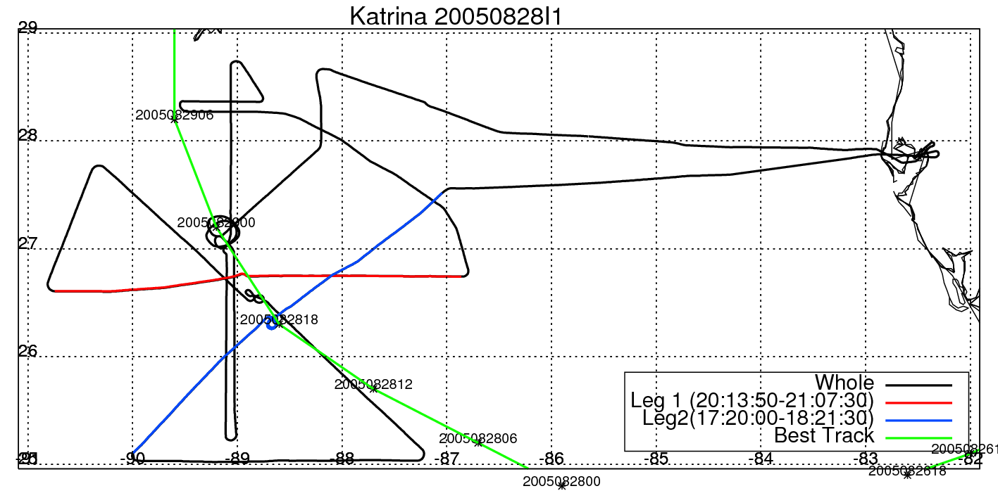
NOAA P3 Flight Level Data For Katrina:
Time Series Plots of Two Eye-Crossing Flight Legs:
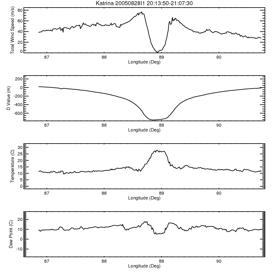
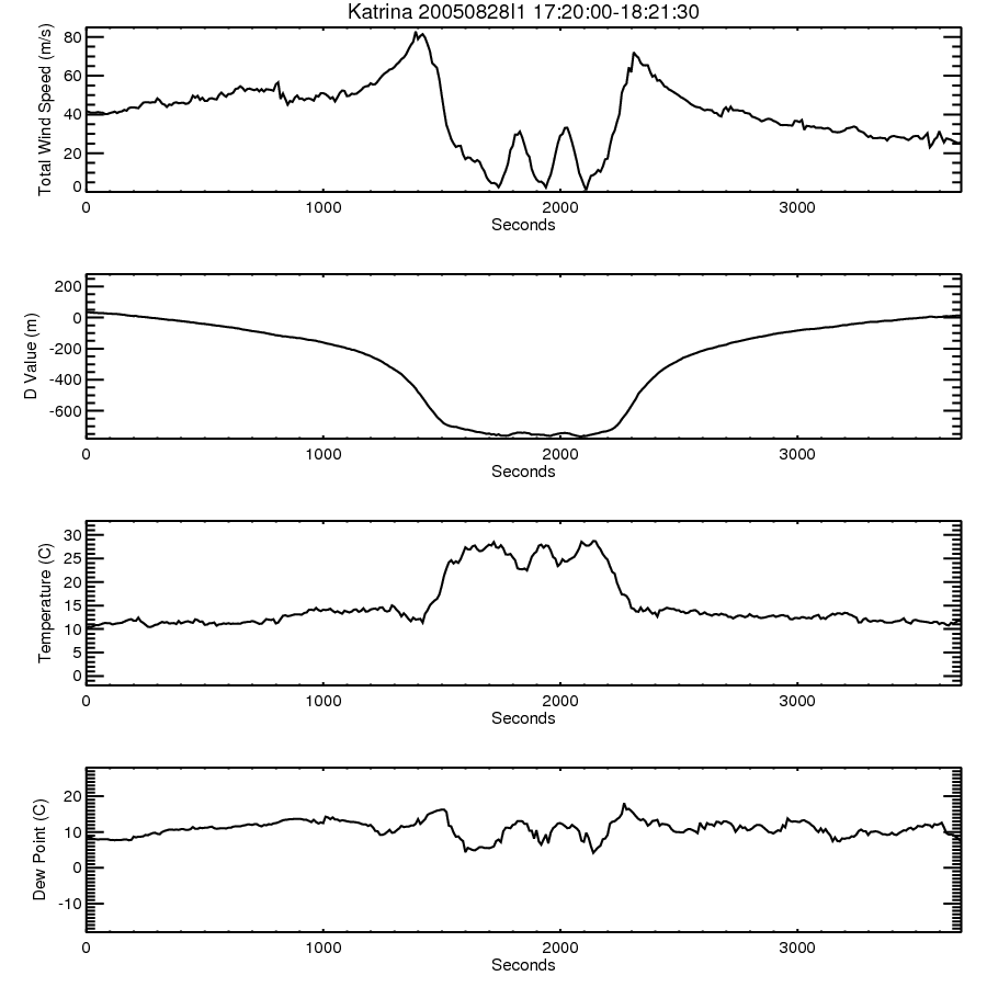
Plots of Wind Speed, Temperature, Dew Point, and D-Values for Selected Flight Legs: