Wasatch Hydrometeor Aggregation and Riming Experiment

For a live feed of snowflakes when it’s snowing, please follow this link to the Snowflake Showcase. Otherwise see this gallery. All images on these pages are copyright Tim Garrett, and are freely available for non-commercial or educational purposes. Otherwise, please contact Dr. Garrett through the ACCS link above.
Garrett, T. J. and S. E. Yuter: Observed influence of riming, temperature, and turbulence on the fallspeed of solid precipitation Geophys. Res. Lett. (in press)
Garrett, T. J., C. Fallgatter, K. Shkurko, and D. Howlett, 2012: Fallspeed measurement and high-resolution multi-angle photography of hydrometeors in freefall. Atmos. Meas. Tech., 5, 2625-2633, doi:10.5194/amt-5-2625-2012
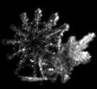
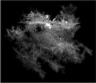
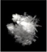
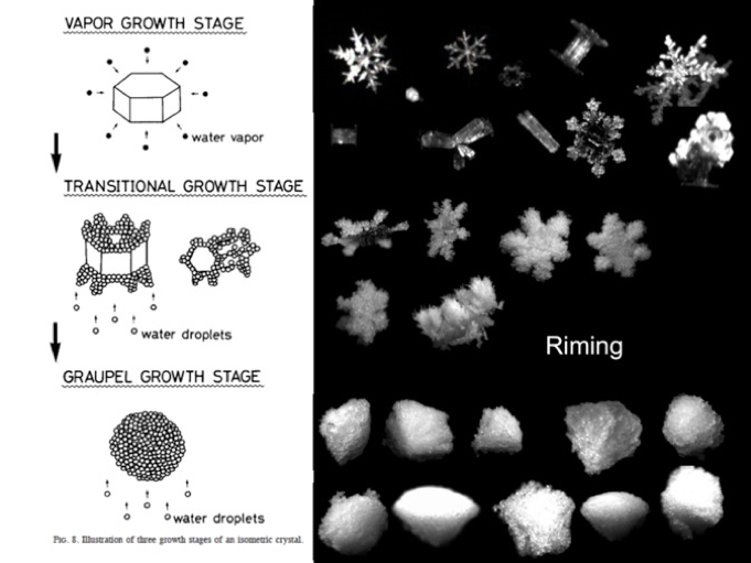
The Wasatch Hydrometeor Aggregation and Riming Experiment (WASHARX) is supported by the National Science Foundation to improve cold weather forecast models through a study into how snowflakes evolve as they fall. One of biggest problems in predicting how much snow will fall and where is to have accurate formulas for a process known as riming, shown below. Snow crystals grow from the vapor phase. But once they get sufficiently large enough to fall, they start to collect cloud droplets. If this happens efficiently, a rimed “graupel” particle grows rapidly from about 0.1 mm to 5 mm across in the space of about 10 minutes. Graupel falls fast. It removes water from a storm quickly, and it causes snow to fall from the storm further upwind than downwind. Currently, most models overpredict the efficiency of graupel formation. We do not know why.
WASHARX aim to address this question by positioning two Multi-Angle Snowflake Cameras at the base and top of Alta Ski Area within Collins Gulch. A droplet spectrometer probe (FSSP-100) measures fog high on the mountain, and a vertically pointing radar at Alta Base peers upward through the storm to point out storm strength and the location of liquid and ice layers. Meteorological instruments profile winds, temperatures and humidities at six locations through the depth of Collins Gulch.
Check out the latest snowflake pictures at this gallery, or this Snowflake Showcase.
Also, we have a a series of lesson plans created for use in 4th through 6th grades that introduce students the processes of aggregation and riming in clouds through a series of hands-on experiments.
Concurrent Doppler radar imagery is available through Sandra Yuter’s group at North Carolina State University
See a presentation outlining this work presented at the January, 2012 American Meteorological Society Meeting in New Orleans and this (105 MB) poster at the CloudSat-Calipso-Earthcare meeting in Paris
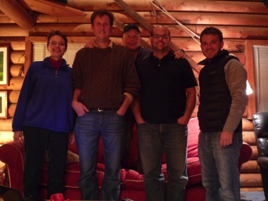
11/11/11: From left to right: Sandra Yuter (NCSU), Tim Garrett (UUTah), Daniel “Howie” Howlett (Alta Ski Area), Cale Fallgatter (UUtah), Nate Hardin (NCSU). Not shown: Konstantin Shkurko (UUtah)